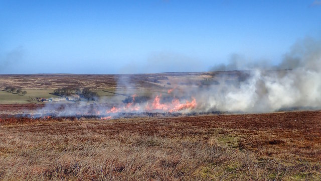
NZ6408 : Heather Burning
taken 10 years ago, 3 km from Commondale, North Yorkshire, England

The moorland were the subject of an 18c agricultural experiment. Sir Charles Turner of Kirkleatham had created a network of ditches over the whole moor and brought in tons of lime to improve the soil.
Normally 800' was considered the maximum height for the cultivation of crops but Kempswithen rises to over 1000'. Much to the surprise of his contemporaries Sir Charles successfully grew crops of wheat and barley although success is perhaps the wrong word considering the expense incurred in the improvements.
The land was abandoned after ten years following a slump in the markets.
In all directions plumes of smoke can be seen on the moors on a good day at this time of the year. The gamekeepers are burning the heather.
Grouse feed on heather. Young shoots provide the best nutritional value but grouse require taller heather for nesting and cover. To provide a managed supply of young heather patches of heather are periodically burnt. This burning cycle, lasting between 7 and 25 years result in the familiar mosaic of colours on heather moorland. The Scots call this muirburn.
Heather can only be burnt by law between 1st October and 10th April when the heather is dry but the undying peat is wet. If done correctly the heather roots are undamaged by the fire and the seeds quickly germinates. But I guess any self sown trees and shrubs such as birch and rowan will be destroyed by the fire so maintaining the North York Moors iconic heather moorland.
