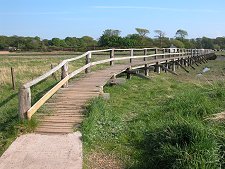
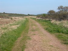
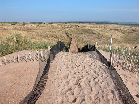
 Looking Back Along the Path from Aberlady Bay Dunes |
Half a mile east of Aberlady a small car park on a bend in the A198 gives access to the Aberlady Bay Local Nature Reserve. This became Britain's first Local Nature Reserve in 1952 and is looked after by East Lothian Council. The total area of the reserve is 582 hectares or 1,439 acres, though two thirds of this is sand, mudflats and salt marsh falling below the high tide mark.
The reserve looks out west along the south side of the Forth Estuary and distant views include Arthur's Seat in Edinburgh with the Pentland Hills to its south, and a little more closely the chimneys of the Cockenzie Power Station. North across the Forth lies the coast of Fife.
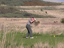
Aberlady Bay is managed to improve the value of the area to feeding wildfowl and waders, breeding birds and the 550 species of plant life which have been identified here. The land above the high tide mark is predominantly flat and is bordered to the east where it starts to rise towards the ridge of Gullane Hill by the western holes of Gullane Golf Club's No1 and No2 courses. As you enjoy the diversity and beauty of Aberlady Bay, spare a thought for those paying up to £100 or more per round for their walk around Gullane Links.
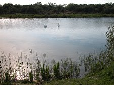
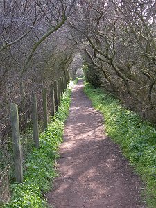
Visitors are asked to keep to the good quality paths that cross the reserve to avoid disturbing the birds and other wildlife, which include a herd of roe deer. The main path leads you through a variety of habitats including a surprise in the form of a freshwater loch and the dense woodland surrounding it.
Further on, open heathland is predominant and as the path nears the sea it enters duneland. The beach you eventually find yourself on is impressive even at high tide, but truly vast at low tide, and the sea can be some distance out. An alternative path takes you further north to the vantage point of Gullane Point.
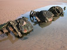
If you arrive on the beach via the main path at low tide, you will just be able to make out to your left, to the south, two dark shapes lying in the sand with the bolder outline of what turns out to be a concrete block between them. The dark shapes are the remains of two midget submarines.
They make a fascinating diversion from the more natural attractions of Aberlady Bay, but any exploration needs to be carried out with great care. The wrecks are a long way out, much closer to the low tide mark than high tide mark, and Aberlady Bay has a reputation for a rising tide that can cover the ground very quickly. Make absolutely sure you know what the tide is doing and leave yourself enough time to get out and back. Tide predictions for Fidra, an island off the coast near North Berwick can be found here.
The midget submarines are XT-Craft, training versions of the X-Craft that attacked the Tirpiz in 1942. In 1946 two of these vessels were towed to Aberlady Bay and moored to a large concrete block, then used as target practice and gun tests by RAF aircraft. Afterwards their badly damaged remains were simply left to rot.
The wrecks have a very poignant feel today. The more southerly of the two is the slightly better preserved, and gives a real sense of the size and shape of the original vessel. It is difficult to imagine four men working underwater in the remarkably confined space of the hull.
When you return to the car park look out for another poignant memorial, this one to Nigel Tranter, the author who died in 2000. He loved this coast, walking it daily and writing as he went. The plaque records his feelings for the bay, as attributed to one of his characters in his 1991 book Crusader: "...he was always glad to return here, to... the unending sigh of the waves on the far sand-bar at the mouth of the bay, the calling of the sea birds, the quacking of the mallard and the honking of the wavering wild geese skeins which criss-crossed the sky."
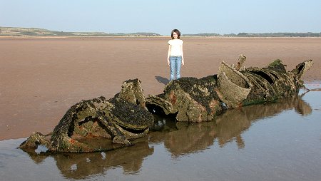 The More Southerly of the Midget Submarines |

|
|
|
Visitor InformationView Location on MapGrid Ref: NT 460 815 Local tide information What3Words Location: ///diner.clocking.disarmed |
 Path and Beach |
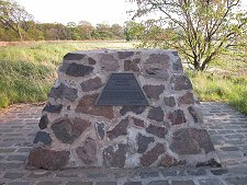 Nigel Tranter
Memorial Nigel Tranter
Memorial |
 Woodland |
