 Earthquake House Seen from the Road |
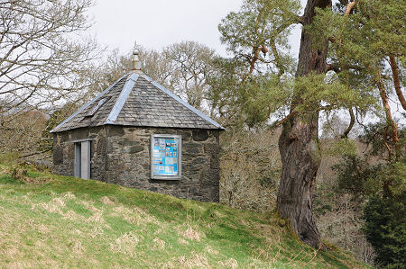
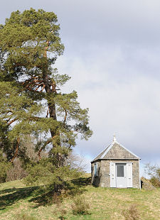
Comrie in Perthshire has a unique claim to fame. It is the earthquake capital of the UK, being subject to more, and more intense, earthquakes than anywhere else in these islands. Because of this it is sometimes referred to as the "Shaky Toun" or, in Gaelic, "Am Baile Critheanach". One result of this is The Earthquake House, built on a rocky outcrop in a field on the west side of the village and said to be Europe's smallest listed building.
Why the geology here should be so active is a matter of debate. The Highland Boundary Fault passes along Strathearn a short distance south of Comrie and is usually said to be the cause. But the epicentre of the quakes tends to lie north of the village. Perhaps there is another fault, as yet unidentified, or perhaps the Highland Boundary Fault slants so that at great depth where the quakes originate it is to the north of Comrie.
Whatever the cause, earthquakes were recorded in Perthshire as far back as 1597, and in Comrie in 1788. It is said that during one decade, the 1830s, over 7,000 earth tremors were recorded in the area, though few of significant size. One that certainly was took place on 23 October 1839. Measuring an estimated 4.8 on the Richter scale, it was felt across Scotland and caused a dam near Stirling to fail. By the 1870s the study of the causes of earthquakes had advanced, and it was decided to build an "Earthquake House" in Comrie with a sensor designed to support this work. The building was erected in 1874.
You reach the Earthquake House by a minor road that turns south off the A85 on the western edge of Comrie before passing over a hump backed bridge. A few hundred yards on is a large layby on the right hand side, with a sign. The Earthquake House stands on a rocky outcrop (so it directly experiences any tremors) in the field on the same side as the layby. Access is on foot up a nearby track, and then via a grassy path from a stile.
By 1911 technology had moved on, and the the building became redundant. It was restored in 1988, and modern sensing equipment fitted by the British Geological Survey. You cannot enter the building, but a window in the door provides a clear idea of what is inside. Most obvious is a sensor fitted into the rock that forms the rear of the floor, which is connected to modern equipment on a shelf. Much less obvious, but in many was more interesting, is the wooden cross set into the floor. This was part of the original "Mallet seismometer". The pegs in the cross supported wooden cylinders of varying width which tumbled in a particular order when a quake took place, so indicating its strength. It sounds primitive, but it seems to have worked.
 Closer View of the Earthquake House |

|
|
|
Visitor InformationView Location on MapGrid Ref: NN 763 215 What3Words Location: ///onlookers.parading.prank |
 Stile from the Lane |
 Original and Modern Sensors |
 Modern Equipment |


