 The Saltire Flying at the Saltire Memorial |
Athelstaneford lies about four miles north-east of Haddington in East Lothian on gentle north-facing slopes that give it extensive views towards North Berwick, The Firth of Forth, and Fife beyond. Athelstaneford has become synonymous with the establishment of the Saltire as the flag of Scotland, for it was near here that an omen of a white diagonally crossed cloud formation against a blue sky was seen prior to battle.
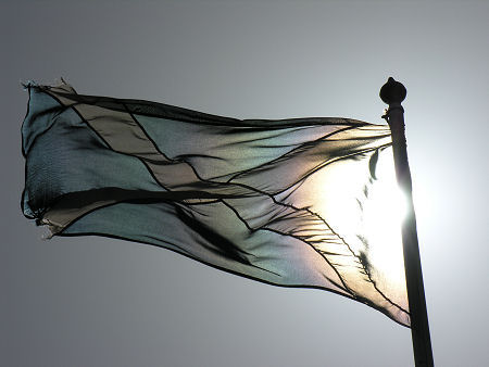
So far, so good. But things get a little confused when you try to tie down precisely when and how Athelstaneford's story and that of the Saltire came together. This is covered in more detail on our Saltire feature page, but we tend to favour the version in which it was Pictish King Angus (or Óengus) who was visited by St Andrew in a dream, and who saw the cloud formation, prior to a battle with a Northumbrian army of Angles under King Athelstan here in 832. The Flag Heritage Centre at the rear of the church helps commemorate these events, as does the Saltire Memorial in the churchyard.
A nice story, but one that has a number of problems. Although the site of the battle is probably a mile and a half north of Athelstaneford, Athelstan wasn't actually born until 895. And he wasn't King of the Angles. He was the first King of England. And he didn't lose in battle to the Scots and Picts. On the contrary. At the Battle of Brunanburh, in 937, he led English forces to victory over joint Scottish and Viking armies under King Constantine II and King Olaf III Guthfrithson. This was one of the most significant battles in British history, defining forever the existence and approximate boundaries of England.
Alternatively and much less romantically, the name may simply come from the Gaelic ath-ail-stane which means "stone ford": though this would make the full name "stone ford ford".
Much clearer is the fact that, though Athelstaneford is an ancient settlement, it owes much to its development as a model village by Sir David Kinloch of Gilmerton in the late 1700s. Cottages were strung along the east-west line of the main street, each comprising two rooms and most costing between £15 and £20 to build.
By 1792 the village was largely complete and a church and school had been built and the parish minister was able to write: "there are few places in Scotland that enjoy greater advantages than Athelstaneford, and none in which the people, in general, are more comfortable, contented or happy." Even the four alehouses in the village were, he said, "attended with no bad consequences, either to the health or the morals of the people."
Today's Athelstaneford seems to have changed remarkably little from the village of 1792. For visitors, the main focus of interest is towards the west end: the Flag Heritage Centre and church. Athelstane Parish Kirk, as you see it today, was built in 1780, on the site of one or more earlier churches going back as far as one built here in 1176, by Ada, the mother of William I.
Paths lead round to the rear of the church, where you find the Flag Heritage Centre, open during Summer months. This is housed in a restored lectern doocot originally built in 1583. Entering the doocot triggers a short audio visual experience relating the tale of the origin of the Saltire.
In front of the church is a memorial to the battle which gave birth to the Saltire, together with a flagpole on which the flag flies. A footpath opposite the kirkyard leads to the ridge the the south of the village and along to the remains of Barnes Castle.
 Athelstaneford Main Street |

|
|
|
Visitor InformationView Location on MapWhat3Words Location: ///icebergs.giggles.robe |
 Village Hall |
 House in Village |
 North End of Village |
 Athelstaneford Parish Kirk |


