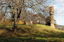
 Rothes Castle with Rothes in the Background |
Part of the way along Rothes High Street, brown tourist signs point along a road joining it from the west indicating the way to Rothes Golf Club and Rothes Castle. If you are driving and turn into the road, you find yourself face to face with the main gates of Glen Spey Distillery. The route you want is up the very narrow and rather pot holed road that climbs to your left.
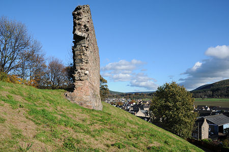
As the road climbs it passes below a steep grassy bank to your right, on top of which is a length of stone wall. This single stretch of wall is all that remains of Rothes Castle. If you carry on driving for a couple of hundred yards, a pull off on the right leads into what may originally have been a quarry, and which now serves as a parking area for the castle and the parkland around it.
From here your view of the castle is of the end of the wall, and as you approach you can see the still pronounced ditch which helped guard access to the castle from the west. As you explore the site, you begin to appreciate why this spot was chosen for a castle. It is built on a fairly narrow spur falling steeply to the road on one side and the distillery on the other: combine this with the ditch across the spur you've already encountered, and the result is a strong defensive location.
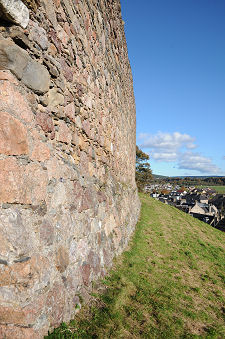
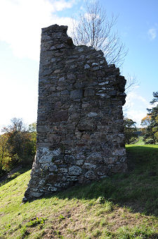
The wall that remains is massive, measuring some 21m in length and up to 7m in height. The outer face curves out at its foot, and it is obvious that the castle once dominated the settlement which grew up around it. At the north-east end of the length of wall is what seems to be a corner. The inner face of the wall carries a number of features which might be interpreted as traces of vaulting of an interior building, and possibly a fireplace. Sharing the top of the spur with the castle but a little distant from it is a relatively modern tin roofed pavilion of unknown purpose.
The origins of Rothes Castle are a little vague. Lands in the area had been granted to the De Pollok family in the late 1100s by William I, and it seems that in about 1200 Peter de Pollok was commanded by William to build a castle where it could control this stretch of the valley of the River Spey. The result was Rothes Castle, apparently built as a keep of several storeys surrounded by a courtyard and outer wall. On 29 July 1296 Edward I of England, the Hammer of the Scots, stayed at Rothes Castle (see our Historical Timeline). In the 1390s the castle and lands passed to the Leslie family, who later became Earls of Rothes.
Rothes Castle was damaged in the 1640s during an attack by Covenanters, and was again damaged by the Marquis of Montrose and his Royalist Army in pursuit of Covenanters in 1645. These attacks appear to have put the castle beyond economical repair, and in 1660 the decision was taken to demolish what was left to prevent its use by "thieves and bandits" who were using it as a base to prey on the area. Much of the stone was later reused when Rothes developed as a planned township in the years after 1766: and if there is any real mystery about Rothes Castle, it is why this one stretch of wall should have survived a process you'd have expected to leave little or no trace on the ground.
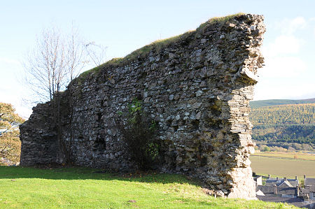 View of the Rear of the Castle Wall |

|
|
|
Visitor InformationView Location on MapGrid Ref: NJ 276 490 What3Words Location: ///named.bikes.repelled |
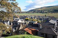 Rothes from the
Castle Rothes from the
Castle |
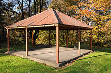 Nearby Pavilion Nearby Pavilion |
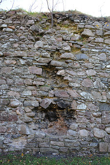 Feature on Wall
Interior? Feature on Wall
Interior? |
