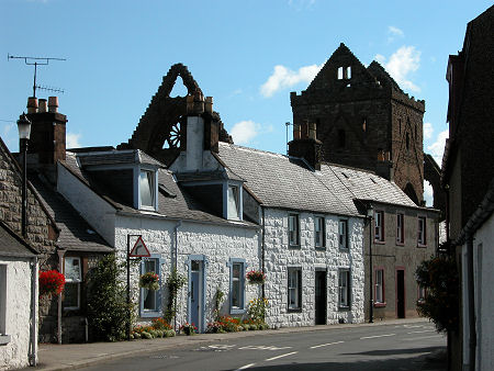
 Sweetheart Abbey and the village of New Abbey |
Dumfries & Galloway is one of the 32 unitary council areas into which Scotland has been divided since 1996. Before that it was also one of the 12 regions into which the country was divided from 1975 to 1996. In terms of physical size, Dumfries & Galloway is the third largest of Scotland's unitary council areas, after Highland and Argyll & Bute. It is only the 12th largest in terms of population, reflecting the largely rural nature of the area. For accommodation in Dumfries & Galloway and a full list of features, see our Dumfries & Galloway area pages.
 Dumfries and Galloway Since 1996 Note About Image Copyright |
Dumfries & Galloway extends from beyond Langholm in the east to Portpatrick in the west, a distance of some 90 miles in a straight line. It also extends north from Scotland's most southerly point, the Mull of Galloway (which is on the same latitude as Penrith in Cumbria and Hartlepool on Teesside) to a point north of Sanquhar on the same latitude as Ayr.
Dumfries & Galloway is bordered to its north by South Ayrshire, East Ayrshire and South Lanarkshire; and to its north-east by Scottish Borders.
Historically, the western half of Dumfries & Galloway formed the Kingdom of Galloway. In the dark ages this was an independent Gaelic-speaking Kingdom, and it retained a degree of independence from the Scottish crown until the 1200s. In more recent times, Galloway was split between the traditional counties of Wigtownshire and Kirkcudbrightshire, while to their east was the large traditional county of Dumfriesshire.
Fast forward to a major reorganisation of 1975, and the name "Dumfries & Galloway" first appeared as one of the 12 regions into which Scotland was divided. This took over the areas of the traditional counties of Wigtownshire, Kirkcudbrightshire and Dumfriesshire. As a region, Dumfries & Galloway was the upper of two tiers of local government. The lower tier was formed by four district councils: Wigtown, Stewartry, Nithsdale and Annandale & Eskdale. The last two divided Dumfriesshire between them, while the first two were based on the areas of Wigtownshire and Kirkcudbrightshire: though Stewartry was rather smaller than Kirkcudbrightshire having lost land to both Nithsdale and Wigtown during the reorganisation.
In 1996, another major reorganisation swept regions and districts away, replacing them with 32 unitary councils. Dumfries & Galloway became one of those councils. It divides its coverage into four management areas that have the same name and the same coverage as the four districts they replaced.

|
|
|
InformationDumfries & Galloway Council:www.dumgal.gov.uk |
 Dumfries and Galloway, 1975 to 1996 Note About Image Copyright |