 |
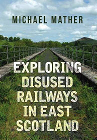
A rather sad map in this book shows Scotland in 1950, with the area south and east of the Great Glen richly covered with red lines indicating operational railway lines. Scotland actually suffered far less badly than it might have done as a result of Beeching and other cuts to lines and services in later decades, but it remains the case that a large number of the lines shown on this map no longer exist. Or do they? "Exploring Disused Railways in East Scotland" by Michael Mather looks at what can still be seen, and in many cases walked or cycled, when following the courses of sixteen of these disused lines. The book is well researched and informative, and is one we know we will want to refer back to in future. It can be highly recommended for anyone with an interest in Scotland's railway history: or who just wants ideas for unusual walks that (by the nature of railways) are less hilly than most you are likely to find in Scotland.
"Exploring Disused Railways in East Scotland" starts with an introduction that sets the scene in terms of the development of railways across Scotland and gives some useful pointers to those intending to explore the lines. Sources of helpful maps are highlighted and reference is made to Scotland's liberal access legislation. There are also practical tips: for example you are likely to find less vegetation blocking your way on less-frequented lines in winter or early spring, but on the other hand cuttings are likely to be boggier at those times of the year.
Most of the book is given over to sections about individual railway lines. By "East Scotland" the author means the large area from Speyside and Fraserburgh in the north to the English border in the south. The opening section looks at the Formantine & Buchan Railway, and from there the general trend is southerly. Examples of lines covered (among others) are the Speyside Railway; the Lochearnhead, St Fillans & Comrie Railway; the Fife & Kinross Railway; lines around Peebles; and the Scottish section of the Border Counties Railway running from Hexham to connect to the Waverley Line at remote Riccarton Junction. Two closed lines in Edinburgh are also covered: The Caledonian Line to Leith and the line from Scotland Street to Granton.
Each section starts with a few introductory paragraphs setting the line it covers in context, and these are followed by a series of excellent photographs showing elements of the line or buildings associated with it that remain on view today. In some cases historical photographs are also used, sometimes to show what's been lost, and sometimes to compare and contrast with modern views of the same scene. The photos are accompanied by excellent captions that add a great deal of value to the book.
InformationPaperback: 96 pagesAmberley Publishing www.amberley-books.com 15 March 2017 Language: English ISBN-10: 1445655675 ISBN-13: 978-1445655673 16.5 x 0.8 x 23.5 cm Buy from Amazon (paid link) Visit Bookshop Main Page |
